We explain what a gulf is, the difference with a bay and with a cape. Also, which are the main gulfs of the world.
What are gulfs?
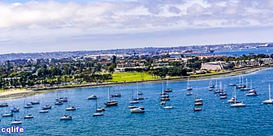
In geography, is known as a gulf or bay to a portion of sea that goes deep into the earth, being enclosed between two points or peninsulas. In principle, both terms can be used to call this type of coastal geographical features, but in Spanish, gulf is usually preferred for large areas of water and bay for smaller ones.
It is a type of geographical feature of great economic and logistical importance for the humanity, since they are ideal for tourist exploitation and for the settlement of ports and docks. In addition, the coasts of the gulfs are usually protected from high tides and other maritime phenomena.
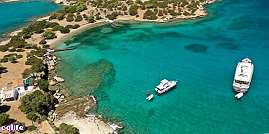
It may also be the case that, within a gulf, there are other smaller bays, which are usually called gulfs, inlets, coves or coves. Likewise, there may be specific and specific differences between these terms: a cove, for example, tends to be smaller than a bay and is even more “sheltered” by the mainland.
Major gulfs of the world
The best known gulfs in the world are the following:
- Bay of Bengal. The largest of the planet, is located northeast of the ocean Indian, on the coasts of Sri Lanka, India, Indonesia, Bangladesh and Burma, extending over 2,172,000 km2 of surface, so much so that it is often considered a sea. It is framed between the Malay Peninsula and the Indian subcontinent itself, and large rivers such as the Ganges, the Brahmaputra and the Meghna flow into it.
- Gulf of Mexico. Located on the coasts of the United States (states of Florida, Alabama, Mississippi, Louisiana and Texas) and Mexico (states of Tamaulipas, Veracruz, Tabasco, Campeche and Yucatán), its 1,550,000 km2 of surface are separated from the rest of the Caribbean Sea through the Florida Peninsula, the island of Cuba and the Yucatan Peninsula.
- Gulf of Guinea. Located in the eastern Atlantic Ocean, on the coasts of west-central Africa, it covers part of the territory of Liberia, Ivory Coast, Ghana, Togo, Benin, Nigeria, Cameroon, Equatorial Guinea, Gabon, São Tomé and Príncipe. Inside they cross the Greenwich Meridian and the equator (the 0 point of latitude and longitude) and has 1,533,000 km2 of surface.
- Gulf of Alaska. It is an arm of the Pacific Ocean in southern Alaska, bounded by the Alaska Peninsula, Kodiak Island, and the Alexander Archipelago. It is a place of constant generation of storms, crossed by the sea current of Alaska, whose 1,531,000 km2 of surface cover the coasts of Alaska and the United States.
- Gulf of Carpentaria. Located off the coast of Australia, in the Arafura Sea of the Pacific Ocean, between the Cape York peninsula and Arnhem Land. Its depth is relatively shallow (it does not exceed 82m) and extends over 310,000 km2.
- Gulf of Saint Lawrence. Located in eastern Canada and communicating with the North Atlantic Ocean, it has an average depth of less than 200m and low salinity. Numerous rivers flow through its 259,000 km2 surface, the most important being the San Lorenzo (3,058 km), and there are numerous large islands, such as Anticosti Island, Prince Edward Island and the Magdalena Islands, among others. In addition, it presents the San Lorenzo Estuary, where the salty water of the gulf goes back to that of the river of the same name.
- Persian Gulf. One of the best known gulfs in the world, due to the war which took place on its coasts in 1990 and 1991, is located between Iran and the Arabian peninsula, thus being an extension of the Indian Ocean. It has an area of 233,100 km2 with an average depth of 30m, very rich in marine life and that bathes the coasts of Iran, Iraq, Kuwait, Saudi Arabia, Bahrain, Qatar, United Arab Emirates and Oman. In addition, it is connected to the Arabian Sea by the Strait of Hormuz and the Gulf of Oman.
- Bay of Biscay. Located in the western part of Europe, on the shores of the Atlantic Ocean, its 225,000 km2 area stretches between Cape Ortegal in Galicia (Spain) and Punta de Pern on the island of Ouessant, in Brittany (France). It is often considered part of the Cantabrian Sea and is an area of important fishing exploitation.
- Gulf of Aden. Also called the Gulf of Somalia, it is located in the Indian Ocean, between the coasts of the African horn and the Arabian peninsula. Its 220,000 km2 area bathes the coasts of Somalia, Yemen, Somaliland and Djibouti, and constitutes a very important access route to the Persian Gulf, in the middle of the oil extraction route, through the Red Sea with which it communicates through the Strait by Bab el-Mandeb.
- Gulf of Oman. Also located in the Arabian Sea, that is, in the Indian Ocean, it communicates with the Persian Gulf through the Strait of Hormuz and bathes the coasts of Oman, the United Arab Emirates, Iran and Pakistan. It has 181,000 km2 of surface and enormous depths of up to 3,692 meters.
- Gulf of California. Better known as the Sea of Cortez or the Bermejo Sea, it is located in the Pacific Ocean, between the Mexican coasts of the states of Sonora and Sinaloa, and the Baja California peninsula. It has an important group of islands in its 153,000 km2 of surface, and its tides are among the most intense in the entire planet, with fluctuations of up to 9 meters in sea level.
- Gulf of Tonkin. Located in the South China Sea, between the coastal territories of China and Vietnam, and the island of Hainan (belonging to China), it extends over 116,000 km2 of surface.It is a shallow gulf (60m on average) and has numerous islands in its northwest region.
Difference between gulf, cape and bay
As we said at the beginning, the terms gulf and bay would essentially be synonyms: entrances to the sea that are surrounded by land. However, the bays are smaller gulfs. But in other languages, such as Portuguese, only the last term is used, so there are no such rigorous delimitations as to when we speak of the gulf and when of the bay.
On the other hand, the capes or points are the extensions of the mainland that "hug" a gulf or a bay, that is, they enclose and delimit it. The capes are easy to recognize because they are points of land in the sea, like the peninsulas, and for that reason they tend to have an important influence on the flow of coastal marine currents.